
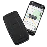
Discover It GPS903-4G Tracker: The Science Behind Long-Life Vehicle & Asset Monitoring
There’s a certain, undeniable weight to not knowing. Is the new car still safely parked where you left it? Did the teenage driver make it to their destination okay? Where exactly is that valuable piece of equipment on the sprawling construction site? This feeling, a blend of anxiety and helplessness, is a deeply human one. In our increasingly connected world, technology offers powerful answers to these age-old questions, transforming uncertainty into awareness. At the heart of this revolution lies the Global Positioning System (GPS), a technology that allows us to pinpoint locations on Earth with remarkable accuracy. Devices like the Discover It GPS903-4G GPS Tracker represent the tangible application of this science, promising real-time tracking and extended operation, all aimed at lifting that weight of the unknown and offering a measure of peace of mind. But how does a small box translate complex satellite signals into a reassuring dot on your smartphone map? Let’s embark on a journey to unravel the science and story behind it.

Whispers from the Sky: The Birth and Magic of GPS
The ability to know one’s precise location anywhere on the globe feels almost magical today, yet its origins lie in the strategic calculations of the Cold War era. The GPS system, officially known as NAVSTAR GPS (Navigation System with Timing and Ranging Global Positioning System), was initially developed by the U.S. Department of Defense. Imagine the immense challenge: creating a system that could allow military assets – ships, planes, soldiers – to navigate accurately, anytime, anywhere, regardless of weather conditions. The solution was breathtakingly ambitious: a constellation of satellites orbiting roughly 12,550 miles above Earth, continuously broadcasting signals back towards us.
Think of these satellites as incredibly precise lighthouses in space. Each one constantly transmits radio signals containing two key pieces of information: its exact location in orbit and the precise time the signal was sent. Down here on Earth, a GPS receiver, like the one inside the Discover It tracker, acts like a ship scanning the horizon for these lighthouse signals. The receiver listens for signals from multiple satellites simultaneously.
Here’s where the “magic” of positioning happens, through a process called trilateration. It’s a bit like figuring out your location in a dark, large room by listening to friends calling out from known positions. If you know where each friend is standing and you can tell how far away their voice sounds (based on how long it took to reach you), you can deduce your own spot. The GPS receiver does something similar, but with radio waves traveling at the speed of light. By measuring the minuscule time difference between when a signal was sent by a satellite and when it was received, the tracker calculates its distance to that specific satellite.
Distance = Speed of Light × Time Delay
When the receiver gets distance measurements from at least four different satellites, it can perform a series of complex calculations to pinpoint its own latitude, longitude, and even altitude. Why four? Three distances are enough to narrow down the location to two points (imagine three intersecting spheres), and the fourth signal helps resolve this ambiguity and corrects for tiny inaccuracies in the receiver’s own clock. The incredible precision of this system relies on atomic clocks aboard the satellites, accurate to within nanoseconds. Initially a military marvel, GPS was opened for civilian use, fundamentally changing navigation, logistics, surveying, and, pertinent to our discussion, personal and asset tracking.

The Unseen Thread: Connecting Position to You via Cellular Networks
Knowing the tracker’s location is only half the equation. How does that information get from the device, perhaps attached beneath a vehicle or tucked into a backpack, to the map on your phone or computer screen, potentially thousands of miles away? While GPS satellites transmit signals, they don’t receive data back from individual trackers. This is where the familiar cellular network steps in, acting as the vital communication bridge.
Think of the GPS tracker as having two key components working in tandem: the GPS receiver (listening to the sky) and a cellular modem (talking to the ground network). Once the GPS receiver calculates its position, the cellular modem takes this location data (latitude and longitude coordinates) and transmits it, much like sending a tiny text message or data packet, over a cellular network – typically the widespread and reliable 4G LTE network. The product description for the Discover It GPS903-4G, despite its model name, also mentions compatibility with “5G (where available)”. While 5G offers higher speeds and lower latency, these aren’t strictly necessary for sending small location updates. Its inclusion might suggest a specific modem feature for potential efficiency gains or future network compatibility, but 4G LTE remains the workhorse ensuring broad coverage across vast areas.
This data packet travels through cell towers to the service provider’s servers and then, usually, to a dedicated cloud platform associated with the tracking service (like the “iTrail” platform mentioned for this device). Your smartphone app or web browser then accesses this platform to display the tracker’s current location and historical path.
This reliance on the cellular network explains why these real-time GPS trackers require a monthly service plan. Just like your cell phone needs a plan to make calls and use data, the tracker needs a subscription to cover the cost of transmitting its location data over the cellular infrastructure. The amount of data used is typically small, but the constant connection capability necessitates the ongoing service fee. Without this cellular link, the tracker might still know where it is, but it would have no way to tell you in real time.
Inside the Black Box: Deconstructing Key Features
Understanding the core principles of GPS positioning and cellular communication allows us to appreciate the specific design choices and claimed features of the Discover It GPS903-4G tracker, viewing them through a scientific and practical lens.
The Endurance Runner: Understanding Battery Life Claims
One of the most prominent claims for this device is an impressive “up to 256 Day Battery Life”. Powering this potential longevity is a built-in Lithium Polymer (LiPo) battery. LiPo batteries are common in modern electronics because they offer high energy density – they can store a lot of energy relative to their weight and size, and they can be molded into various shapes.
However, that “up to” is crucial. Achieving such extended battery life is akin to a marathon runner conserving energy for the long haul. It depends almost entirely on how frequently the tracker is asked to report its location and the conditions it operates in.
- Update Frequency: This is the single biggest factor. If the tracker is set to update its position only once a day, it spends most of its time in a low-power “sleep” state, waking up briefly to get a GPS fix and send a quick cellular update. In this mode, lasting many months is conceivable under ideal conditions. Conversely, if you need near-constant tracking, setting updates for every minute or even every few seconds, the GPS receiver and cellular modem are working almost continuously. This is like sprinting – energy is consumed rapidly, and the battery life might drop to days or weeks, not months.
- Signal Strength: Poor GPS or cellular signal forces the device’s radios to work harder and longer to acquire a fix or transmit data, consuming more power.
- Temperature: Extreme cold or heat can negatively impact battery performance and longevity.
Therefore, the 256-day figure should be viewed as a best-case scenario under minimal usage settings. The real value lies in the flexibility it potentially offers. Users can balance their need for real-time information against the desire for extended periods between charges, configuring the update rate accordingly via the associated app. It’s a trade-off: more frequent updates provide a more detailed picture of movement but require more frequent recharging.
Bridging Borders: Connectivity Explained
The claim that the tracker works across the U.S., Canada, and Mexico highlights the capabilities of its internal cellular modem. For seamless operation across these countries, the modem must support the specific 4G LTE frequency bands used by cellular carriers in all three regions. This cross-border functionality is essential for vehicles or assets that travel internationally within North America, ensuring continuous tracking without interruption (provided a suitable service plan covering roaming is active). As discussed earlier, the mention of “5G where available” likely points to the modem having some level of 5G compatibility, although the primary connection for broad coverage would rely on the more established 4G LTE networks.
An Electronic Fortress: Durability and Secure Mounting
Tracking often involves placing devices in less-than-ideal environments – under vehicles exposed to road grime and weather, or attached to equipment on rugged sites. The Discover It GPS903-4G’s design addresses this with a case made from ABS (Acrylonitrile Butadiene Styrene) plastic, described by the manufacturer as waterproof, crushproof, and dustproof.
ABS is a common thermoplastic known for its robustness, impact resistance, and rigidity – it’s the same kind of durable plastic used in things like Lego bricks, automotive parts, and protective headgear. These properties make it a suitable choice for housing sensitive electronics that might face bumps, vibrations, and exposure to the elements. While specific ratings like IP (Ingress Protection) codes aren’t provided in the description, the claims suggest a design intended to withstand typical outdoor and vehicular conditions.
Equally important for vehicle or equipment tracking is secure mounting. The device features dual magnets claimed to have an “80lb direct pull force rating”. What does this mean? Pull force measures the force required to detach the magnet straight from a flat steel surface. An 80lb rating indicates very strong magnets (likely Neodymium magnets, known for their high strength-to-size ratio). This high pull force is designed to ensure the tracker remains firmly attached to a magnetic surface on a vehicle’s chassis or equipment frame, even when subjected to significant vibrations, bumps, or jarring movements encountered during normal operation. Proper placement on a clean, flat, ferrous metal surface is key to achieving this maximum holding power.
Drawing Lines on the Map: The Intelligence of Geo-Fencing
Modern GPS tracking is more than just showing a dot on a map; it incorporates intelligent features for proactive monitoring. The Discover It tracker utilizes the “iTrail” application, which allows users to set up geo-fences.
Imagine drawing a virtual boundary line around a specific area on the digital map within the app – perhaps around your home, your child’s school, a workplace, or a designated job site. This is a geo-fence. You can then configure the system to send you an automatic alert (the description mentions text messages) whenever the tracker enters or exits this pre-defined zone.
The value here is automation and reduced anxiety. Instead of constantly needing to check the tracker’s location, you can rely on the system to notify you of significant movements related to important locations. The description mentions the ability to create an “unlimited number” of these custom zones, offering considerable flexibility for monitoring various locations relevant to the user’s needs. This feature transforms the tracker from a passive location reporter into an active monitoring assistant.
Technology in Action: Real-World Scenarios
The convergence of these technologies – precise GPS positioning, reliable cellular communication, potentially long-lasting power, robust design, and intelligent software features – enables a wide range of practical applications across North America:
- Parental Peace of Mind: Monitoring a newly licensed teen driver’s location, confirming their safe arrival at school or home without constant check-in calls. Setting up geo-fences around permitted areas can provide automatic notifications if boundaries are crossed.
- Vehicle Security: Quickly locating a stolen car or motorcycle, significantly increasing the chances of recovery. Tracking the location of recreational vehicles like RVs or boats when not in use.
- Asset Protection: For businesses or individuals, tracking valuable mobile assets like construction equipment, trailers, generators, or even high-value cargo shipments. Knowing the precise location deters theft and aids in logistics management.
- Fleet Management: Small businesses can monitor the location of their service vans or delivery trucks in real-time, optimizing routes, verifying service calls, and improving overall operational efficiency.
- Caregiving Support: Providing an extra layer of safety for vulnerable individuals, such as seniors prone to wandering or children during unsupervised periods, by allowing caregivers to quickly ascertain their location if needed.
In each case, the underlying technology serves the fundamental human need for security, awareness, and control over valuable assets or the well-being of loved ones.

Beyond the Dot on the Map: Conclusion and Reflection
The Discover It GPS903-4G, like many devices of its kind, represents a remarkable miniaturization and integration of complex technologies. It’s a pocket-sized testament to the power of satellite navigation born from military ambition, the ubiquity of cellular networks that connect our world, advancements in battery chemistry that extend operational life, and clever software that transforms raw location data into actionable insights.
Understanding the science – the whispers from GPS satellites, the trilateration calculations, the cellular handshake, the energy trade-offs of battery life, the properties of materials like ABS plastic, and the logic of geo-fencing – allows us to appreciate such a device not just for what it does, but for how it achieves it. It bridges the physical and digital realms, offering a powerful sense of connection and oversight in a world that often feels vast and unpredictable. While specific performance claims always warrant careful consideration of real-world conditions, the fundamental capability provided by this blend of technologies undeniably offers a potent tool for enhancing security, efficiency, and, perhaps most importantly, peace of mind. It’s more than just a dot on a map; it’s a small piece of accessible science working to answer that persistent question: “Where is it now?”